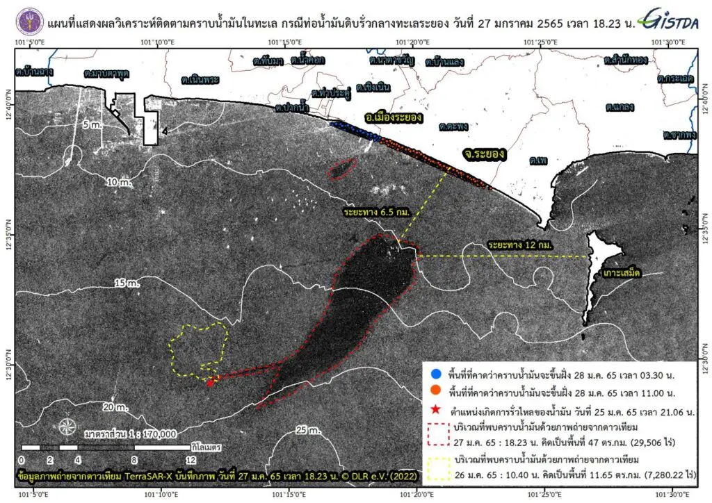
BANGKOK, Jan 28 (TNA) – A satellite photo supplied by the Geo-Informatics and Space Technology Development Agency (GISTDA) showed oil slicks in the Map Ta Phut bay covered 47 square kilometers, nine times bigger than Ko Samet.
GISTDA released the picture taken by the TerraSAR-X satellite at 6.23pm on Jan 27 as it followed the crude oil leaked from an undersea pipe at a loading buoy in the bay about 20 kilometers southeast of the Map Ta Phut port at the night of Jan 25.
The picture showed that the oil slicks expanded to an area of 47 square kilometers, equivalent to nine times the size of Ko Samet, about 6.5 kilometers from Muang district of Rayong and about 12 kilometers from Ko Samet.
They were moving northeasterly and were expected to be washed ashore on Jan 28 and have impacts on the coast of Muang district, the Mae Ramphueng beach and nearby beaches. (TNA)
